influxdata / influxdata/giraffe
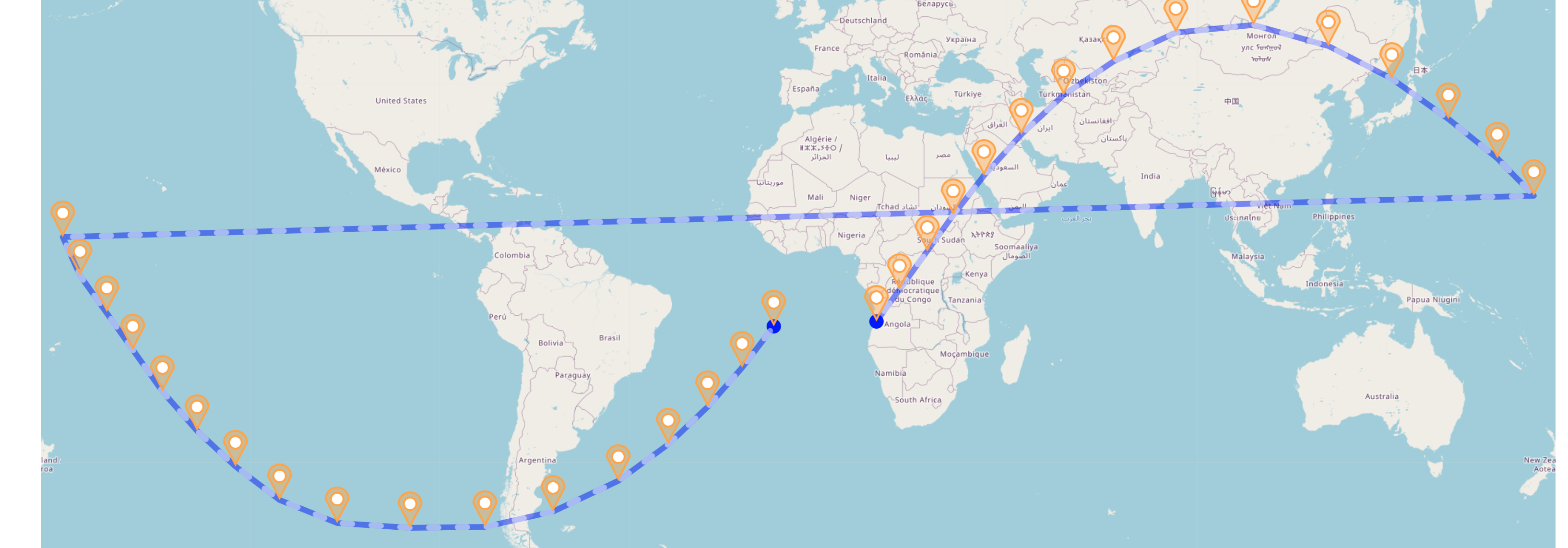
Geo graph with Tracks layer draws horizontal line across map when mapping an orbit
- Dominant language
- TypeScript
- Stars
- 189
- Forks
- 33
- Avg merge
- 3d 15h
- Merged PRs (30d)
- 4
Description
I'm working on a project to map the movement of the ISS and I'm using Giraffe to plot these geo points. The issue I'm experiencing is that when longitude wraps from 180 to -180, Giraffe plots a line across the map to try and connect these points. See the picture below. The yellow points are my data - notice how there are no data points between the left-most yellow pin and the right-most yellow pin but Giraffe still plots a line between them.
Technically you could argue that this line does have to exist to connect the two points - but I think it would be nice if Giraffe handled this differently. If the points "wrap" the longitude scale (-180 -> 180) then the I think the line should not be drawn.
Contributor guide
Assessment
This issue has not been assessed yet.