Adding Geographic Bounding Box to file level metadata
Open
Nobody has claimed this yet.
Feature: File Upload & Handling
Feature: Geospatial
Feature: Metadata
Type: Suggestion
User Role: Depositor
- Dominant language
- Java
- Stars
- 1.1k
- Forks
- 564
- Avg merge
- 2d 2h
- Merged PRs (30d)
- 29
Description
Is it possible to add Adding Geographic Bounding Box to the file metadata? UCLA Dataverse is adding Lidar data. The individual files in the dataset also have bounding box information. I'm pasting a lidar example below.
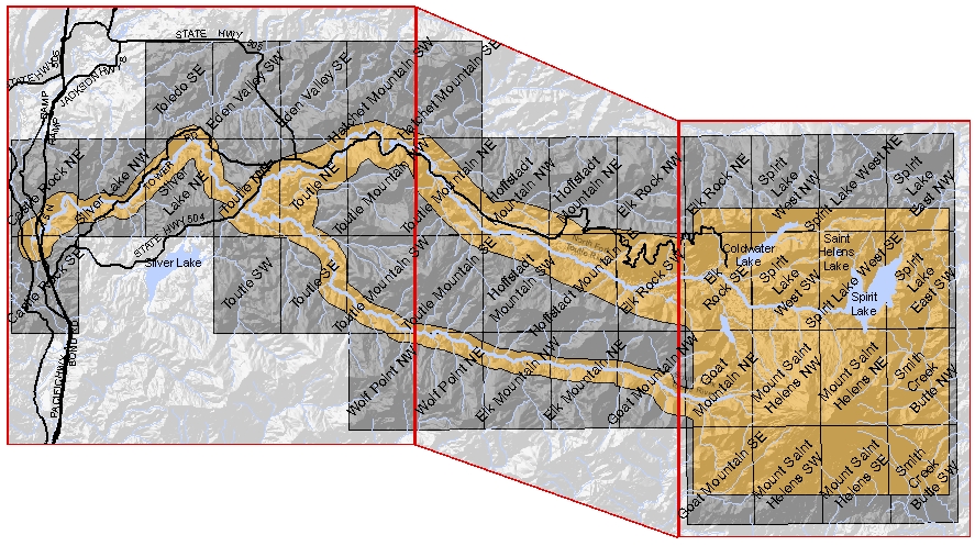
Users tend to pick individual blocks from a lidar dataset rather then the entire dataset.
Contributor guide
First steps
- Read the whole issue, then the project's contributing guide.
- Comment on the issue to say you are picking it up — it saves two people doing the same work.
- Fork the repository and make your change on a branch.
- Open a pull request that references the issue number.
Research direction
No source files, tests, or entry points are named. Begin by locating how Dataverse represents file-level metadata and geographic metadata, then confirm the expected bounding-box fields and how users should see or search them. Done means the behavior and metadata representation are specified well enough to implement and verify.
Written by the indexing model from the issue text.
Assessment
- Tech stack
- java
- Domain
- data
- Issue type
- Feature
- Difficulty
- 5/5
- Estimated time
- Over a week
- Activity status
- Stale
- Clarity
- Needs clarification
- Newbie friendliness
- 25/100