GenericMappingTools / GenericMappingTools/gmt
Allow psclip to work with (x,y,z) coordinates
- Dominant language
- C
- Stars
- 979
- Forks
- 414
- Avg merge
- 17h 26m
- Merged PRs (30d)
- 54
Description
**Description of the desired feature**
I want to make some 3-D pseudo perspective view of a geoelectric model. Having a psclip that work with (x,y,z) coordinates will help a lot.
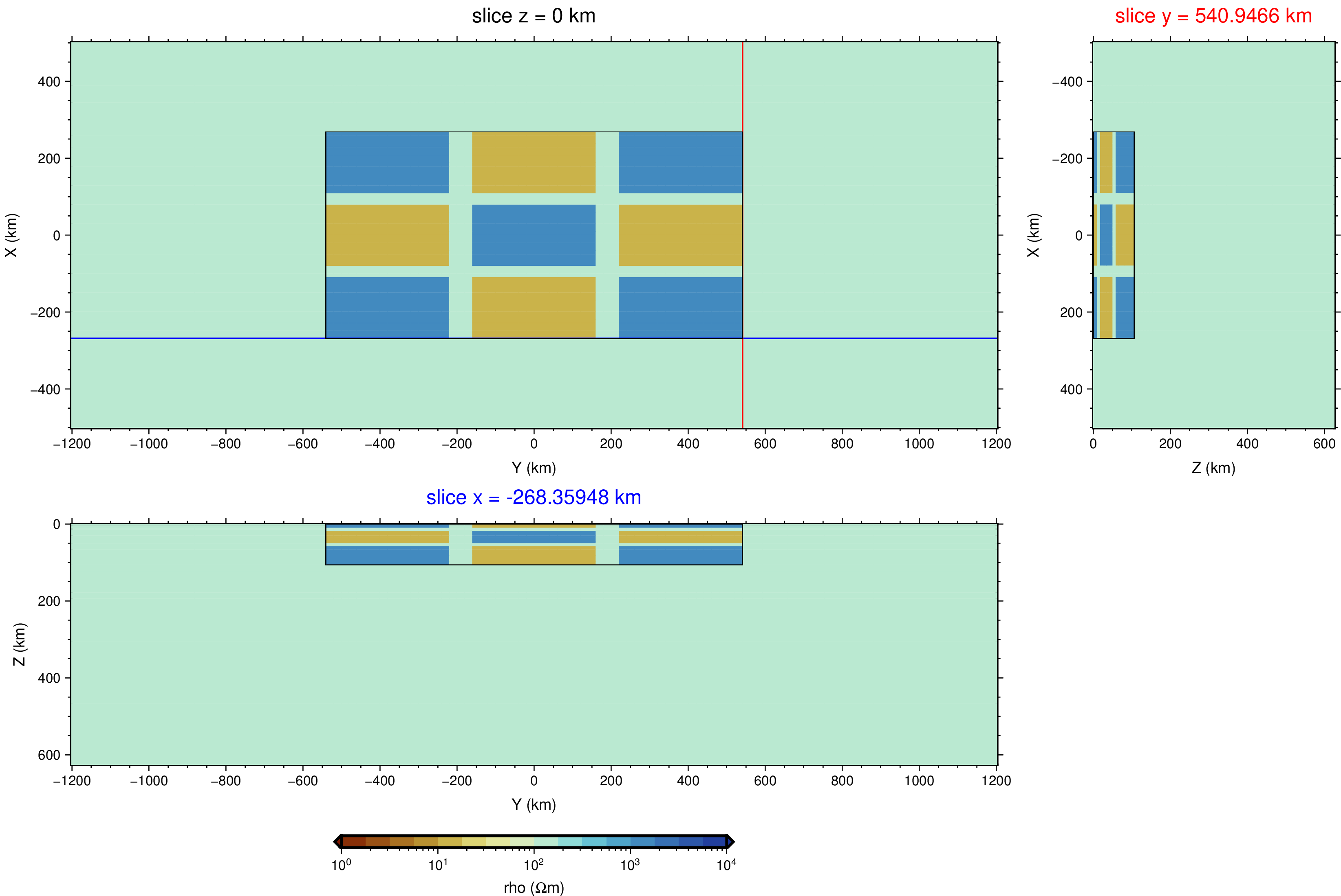
To illustrate it, I will use a synthetic model, as shown below:
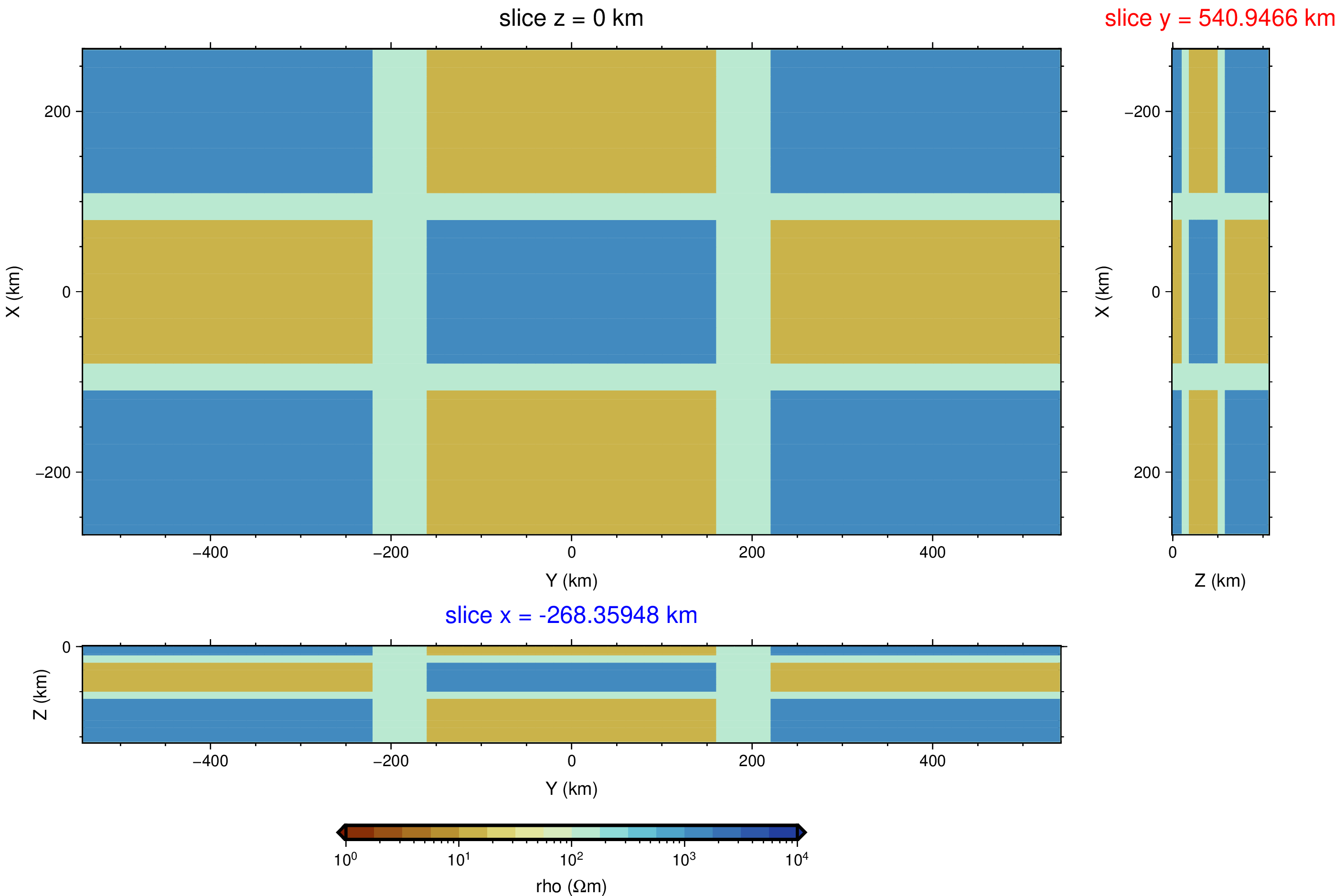
I wish to show only the central part of the model:
Using only gmt and some simple awk edition, all that I could get is:
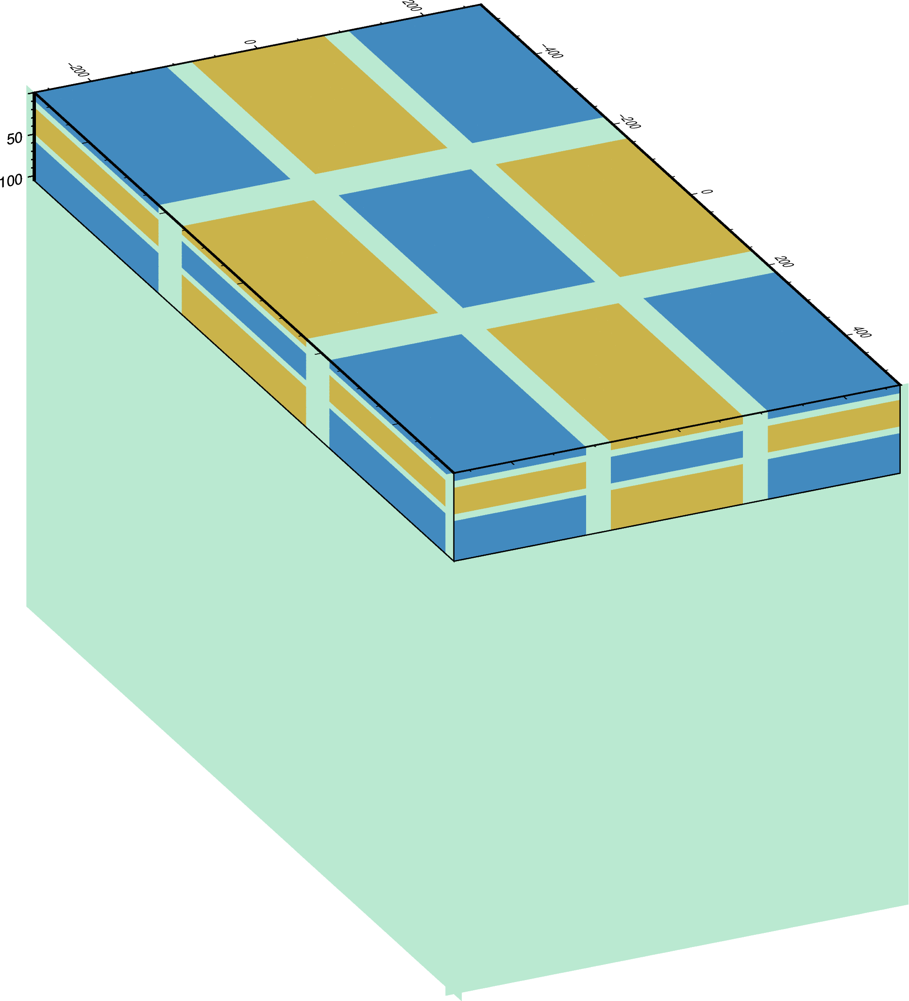
As mentioned in the [forum,](https://forum.generic-mapping-tools.org/t/how-clip-the-side-of-a-3d-plot/1212) I was not able to clip the sides of a 3D plot.
What I wanted to get would be like this:
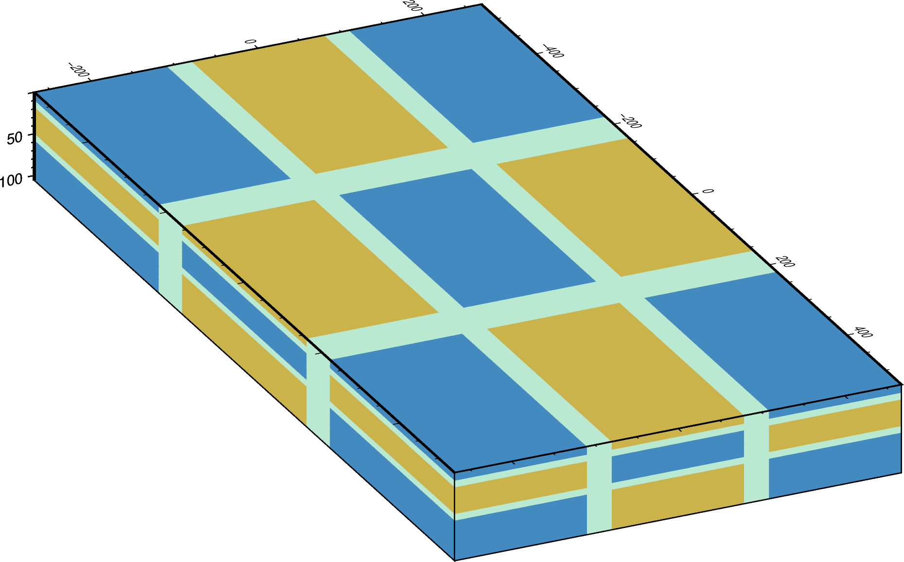
In this case, I used a python program to select the data in the range, but this solution is not generic.
I think it could be very useful if it could be done using psclip.
Follow the data and scripts that I used to make these figures.
[psclip3D.zip](https://github.com/GenericMappingTools/gmt/files/5862548/psclip3D.zip)
**Are you willing to help implement and maintain this feature?** Yes/No
Yes. But not sure how.
Contributor guide
Assessment
This issue has not been assessed yet.