Wrong zoom level beyond 45.88°N and 45.88°S
- Dominant language
- JavaScript
- Stars
- 15.7k
- Forks
- 3.9k
- Avg merge
- 4d 6h
- Merged PRs (30d)
- 34
Description
For some reason Cesium uses a lower zoom level north of 45.88°N and south of 45.88°S when terrain is activated. It also happens when terrain is disabled, but a bit closer to the equator (somewhere around 45°).
It does not depend on tilt/rotation/roll, and the imagery appears pixelated when zooming in. It appears to be constantly using tiles of one zoom level less than it should (e.g. when zooming in the tiles closer to the pole switch from 13 to 14 while at exactly the same time the ones closer to the equator switch from 14 to 15). That appears to be the case at any zoom level but is obviously more notable the closer you get.
It also is not an issue with the tiles as it happens with any tile provider, including those served through Cesium Ion.
I'm still using Cesium 1.76 but it also happens in the sandcastle with Cesium 1.8.
⇒ **[Sandcastle example](https://sandcastle.cesium.com/#c=tVLfa9swEP5XhPvigCPH7TJC6oYxl8FgvyChe5j3oEhnR1SWiiQ7eKX/+2TLqV2Wjr3ML9Z9d9/xfXfXEI0qxUCYWyjQDcrA8LrCVAOx4CBSC/uxIiXo9ptWDWeg7zgcP/eUcHady8Z1aBwE2tElHE8t7noszAPax5mSlnAJOg8i9JhLNHwWtHb4qfn6pYLvSgu28yXhLBpp/DVN69HOpNyAAGqBvWZlwvqR/ByIT529XG6JZJQYKwATxnZKiT3R72trlXTuPogWfVHaHjpfRS2p5UqicOY9+sFgSirQBBei3alwMM/AWC5JV/5sOiPauheRV7jQqrqFUgOYcJ5cXuJVhN4s8cr9kuViscALP45e5D8r3ar6vypN3q7w1TJC879JDaIgNbYVsDkt6B2vHtwMUa1FiHFsoXoQbvsm3tf0HiymxniHvvyiE5sdiCyBPS/5wksf4OmJMW5cu3aNpJJwPeJ7Qu9LrWrJ5lQJ5W5PA5vkB/B44HakPflHGk8dpIw3iLObM8eOqCDGuExRC7HlvyAPNmns6v+gCkUYl+XXBrRT25Udks0nD2KM09iF55nWb9pRTirH3GRULt8dPBrCaa8XFqZzdJysj8+xpu/f)** (see toolbar buttons)
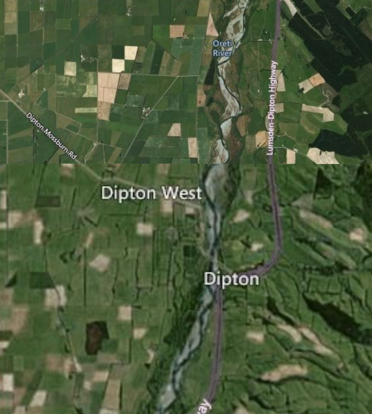
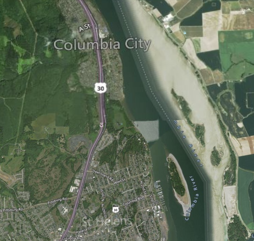
Here are some example screenshots using Bing Aerial with Labels:
New Zealand (45.88°S)
US (45.88°N)
Contributor guide
Research direction
Start by running the linked Sandcastle example with terrain enabled and disabled, then reproduce the imagery level change near 45.88°N and 45.88°S using the shown tile provider. Trace the terrain and imagery tile-selection entry points to identify why neighboring regions choose different levels at the same zoom. Done means the appropriate imagery level is selected consistently across these latitudes for the reported configurations.
Written by the indexing model from the issue text.
Assessment
- Tech stack
- javascript
- Domain
- computer-graphics
- Issue type
- Bug
- Difficulty
- 4/5
- Estimated time
- 3-5 days
- Activity status
- Stale
- Clarity
- Mostly clear
- Newbie friendliness
- 38/100