ArduPilot / ArduPilot/MissionPlanner
3D map does not correctly render camera direction in some angles
- Dominant language
- C#
- Stars
- 2.4k
- Forks
- 2.9k
- Avg merge
- 19h 16m
- Merged PRs (30d)
- 4
Description
#### Issue details
The screenshot shows that the drone is pointed with its nose to the ground, but the sky is visible on the 3D map

In other positions, the camera direction is drawn correctly
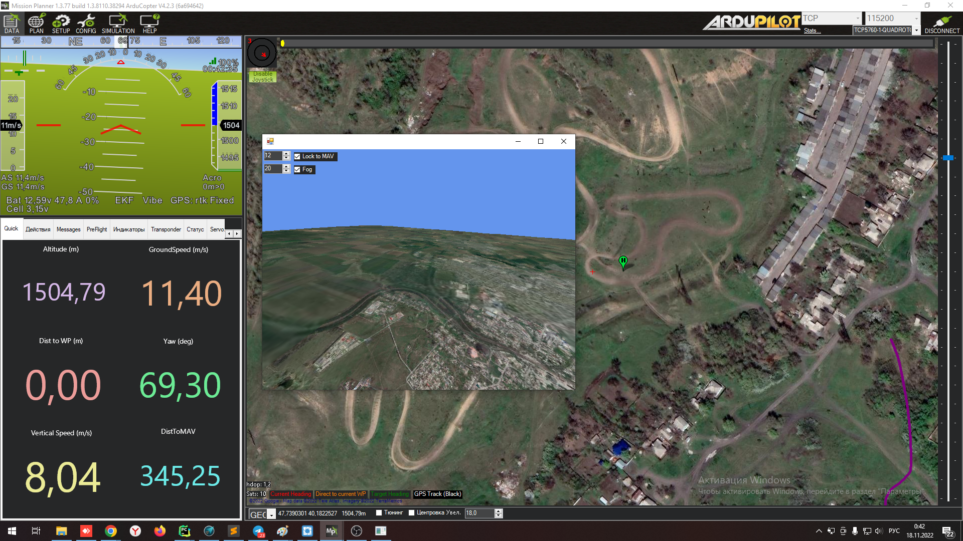
More details can be seen on the video by comparing the position of the horizon with the picture of the 3D map:
https://youtu.be/QgvYjIG9-Ik
#### Version
Mission Planner 1.3.77 build 1.3.8110.38294
ArduCopter V4.2.3
#### Platform
[ ] All
[ ] AntennaTracker
[X] Copter
[ ] Plane
[ ] Rover
[ ] Sub
#### Airframe type
frame +
#### Hardware type
ardupilot on SITL
Contributor guide
No contributing guide indexed for this repository
Research direction
Start by reproducing the camera-direction mismatch in Mission Planner 1.3.77 with ArduCopter SITL, using the screenshots and linked video to compare the drone orientation, horizon, and 3D map. Done means the 3D map consistently shows the correct camera direction across the reported angles.
Written by the indexing model from the issue text.
Assessment
- Tech stack
- csharp
- Domain
- computer-graphics, desktop
- Issue type
- Bug
- Difficulty
- 4/5
- Estimated time
- 3-5 days
- Activity status
- Stale
- Clarity
- Needs clarification
- Newbie friendliness
- 35/100