ArduPilot / ArduPilot/MissionPlanner
Flight Data screen and Configuration inconsistent units
- Dominant language
- C#
- Stars
- 2.4k
- Forks
- 2.9k
- Avg merge
- 19h 16m
- Merged PRs (30d)
- 4
Description
#### Issue details
This issue is somewhat similar in scope to #1802, but I feel is different enough to warrant it's own description. There was some minor discussion on the forums about unit output from over a year ago found [Here](https://discuss.ardupilot.org/t/units-inconsistent-within-mission-planner/29149). Hopefully someone else knows/can reproduce the issue below as well.
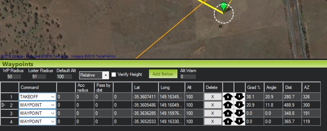
After starting Mission Planner and configuring a SITL plane instance:

And after producing a new mission and launching the aircraft:
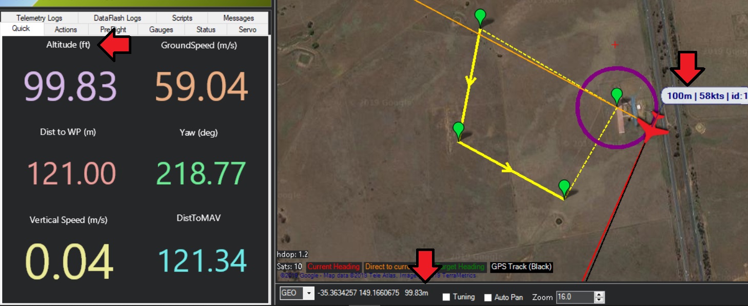
I note that the flight data window reflects altitude units differently in a couple locations. On the moving map (near the aircraft symbol) and underneath the moving map area the units are in meters. However in the quick change panel units are displayed in feet:
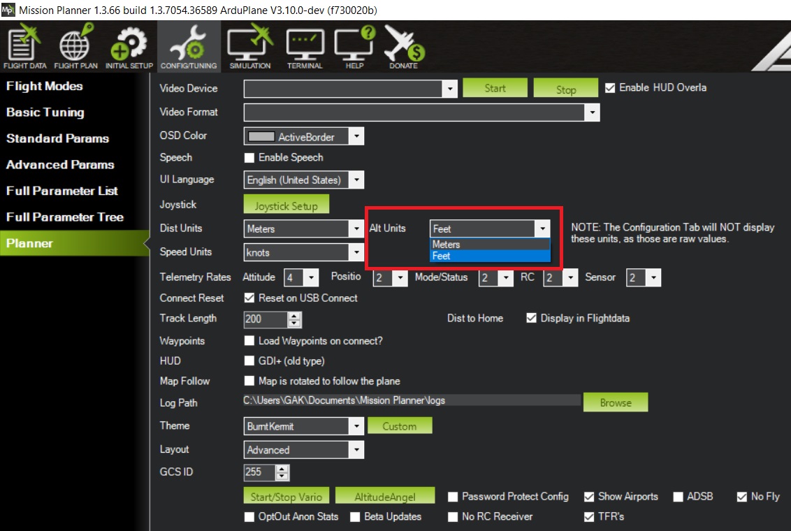
Thinking I'll switch altitude units and see what changes I navigate to and select "feet" as the new altitude units: **Software Config** -> **Planner** -> **Alt Units**:
What we see back in the flight data window is the quick change and moving map area (near the aircraft again) reflect the correct altitude in feet, but the altitude below the moving map is stuck in meters.
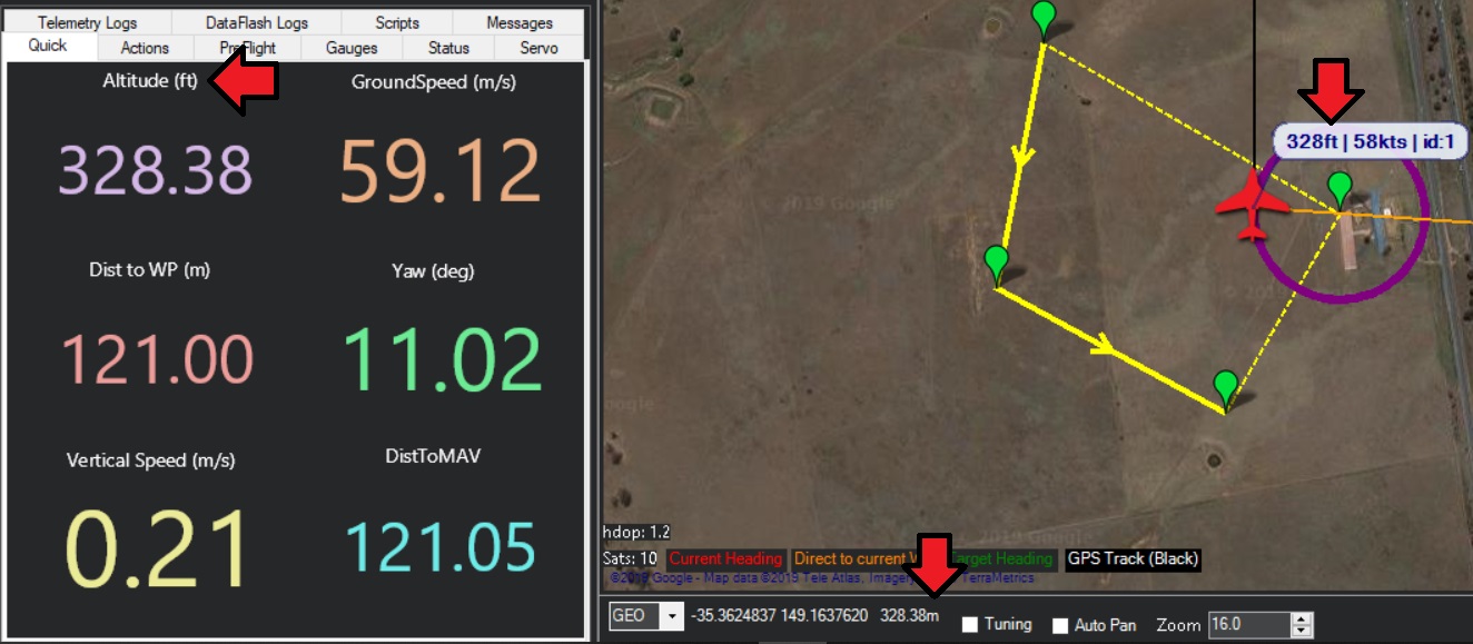
Switching back and forth between altitude units reflects the same issue repeatedly.
I'll get started trying to narrow it down. Appreciate any and all input.
#### Version
Mission Planner 1.3.66 build 1.3.7054.36589
ArduPlane V3.10.0-dev
#### Platform
[ ] All
[ ] AntennaTracker
[ ] Copter
[X] Plane
[ ] Rover
[ ] Sub
#### Airframe type
Plane
#### Hardware type
SITL
Windows 10
#### Logs
N/A
Contributor guide
No contributing guide indexed for this repository
Research direction
Reproduce the issue with a SITL plane, then inspect the Flight Data screen and Software Config → Planner → Alt Units behavior. Compare the moving-map, quick-change panel, and below-map altitude displays after switching between meters and feet; done when all locations consistently follow the selected altitude units.
Written by the indexing model from the issue text.
Assessment
- Tech stack
- csharp
- Domain
- desktop
- Issue type
- Bug
- Difficulty
- 3/5
- Estimated time
- 1-2 days
- Activity status
- Stale
- Clarity
- Mostly clear
- Newbie friendliness
- 30/100